
Location: Town of Brighton, Monroe County
Size: 52 acres
Description: This 52-acre park offers breathtaking scenery, including wonderful waterfalls and an historic tunnel. It also features a variety of habitats, including a Creek (Allens Creek), a marsh, open fields, and mature woodlands on the surrounding hills forming the valley. These host salmon, trout, turtles, and a variety of birds and mammals. The Glen is a traditional migratory stopover for birds in the spring and fall and remains a haven for wildlife including great blue herons, wild turkeys, deer, and beaver.
Corbett's Glen is surrounded on three sides by sandy ridges deposited as the glaciers that once covered the area melted and receded. Upon entering the Glen, one is struck by the feeling of being nestled in a special place, far from the hectic pace of modern life. Remnants of its previously forested state are located on the higher elevations of the Glen where some oaks are estimated to be over 150 years old.
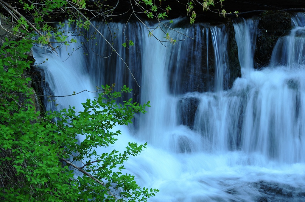
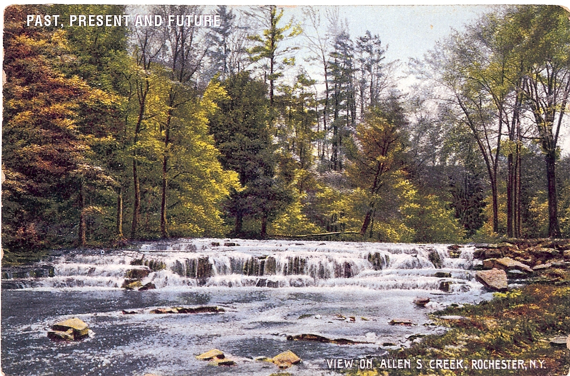
Trail Description: Approximately 2.8 miles of trails are found in the park, with a level loop at the southern end along Allens Creek with the well-known Postcard Falls and historic tunnel under the railroad embankment. Connected by a steep hilly walk, the trails travel through wooded areas in the northern section.
Most trails are wood chip, with a boardwalk over a particularly wet area and a 0.35-mile stone dust loop from the Penfield Road parking area.
![Nigel P. Kent Corbetts 5 DSC_1719 [1024x768].jpg](https://images.squarespace-cdn.com/content/v1/5a706ed2a9db0982d16b9892/1529517816631-W6T4TNVCTJN3Z305CEZD/Nigel+P.+Kent+Corbetts+5+DSC_1719+%5B1024x768%5D.jpg)
![Corbetts 24 DSC_1740 [1024x768].jpg](https://images.squarespace-cdn.com/content/v1/5a706ed2a9db0982d16b9892/1612471146618-OCXRQWITEH773D1JM9HJ/Corbetts+24+DSC_1740+%5B1024x768%5D.jpg)
Photos by Nigel P. Kent
History: The Glen was once an important Native American trading ground. Rochester journalist Arch Merrill has written about the well-trodden trails coming into the area where the creek passes under the New York Central Railway. The Seneca Indian trail led to Irondequoit Creek and followed Allens Creek from the area near East Avenue through the Glen.
A railroad embankment on the property was built in 1882. The vaulted arch bridge over Allens Creek is believed to be the largest in upstate New York. The stone for the arch was quarried from bedrock at the edge of the Glen.
The Glen is also the previous home to a pre-Civil War powder mill. It has been reported that powder from this mill was carted as far as Lockport and used to blast out larger locks when the Erie Canal was being enlarged.
The first documented landowner lived in the Glen in 1833; Patrick Corbett purchased the land in 1890 and developed the land into one of the area's largest truck farms. Recognizing the idyllic setting and natural beauty of his home, Corbett opened a private park which became a popular picnic spot for local groups.
Some Rochesterians have fond memories of attending Camp Hideaway, which operated in the Glen during the 1960s.
In a 1974 article, Clarence Zornow described with fond recollection the Glen as a great place for picnicking and where the trolley line, which ran from Rochester to Syracuse, would bring many picnickers out from the City to the Glen.
Preservation: Preservation efforts for the Glen have been a long-term effort. Brighton's 1970 Comprehensive Development Plan recommended that Corbett's Glen "be preserved in its natural state."
In 1974, the Brighton Town Board voted to have the town supervisor explore various avenues open to the town to obtain aid to help purchase the Glen. Brighton's 1990 Master Plan recommended maintaining the Glen as an open space. And in 1996, Corbett's Glen was given a "highest priority" ranking by the Monroe County Environmental Management Council for protection as an environmentally sensitive area.
In 1999 the Town of Brighton and Genesee Land Trust agreed to a partnership to save the Glen. Genesee Land Trust secured a purchase contract for the Glen and embarked on a fundraising campaign. On June 24, 1999, the acquisition of the Glen was celebrated and Corbett's Glen Nature Park was formed.
Genesee Land Trust continues to serve on the town's Corbett's Glen Advisory Council.
Getting There
Driving Directions: Between Penfield Road and Glen Road which branches off Linden Avenue near Route 441. To access the south end, park on the side of Glen Road and walk through the railroad tunnel to access the park trail. To access the north end, park in the lot off of Penfield Road across from Forest Hills Road.
Approximate Address of Parking: 415 Penfield Road, Rochester, NY 14625
GPS Coordinates: 43.137567,-77.526644